The useful distinction
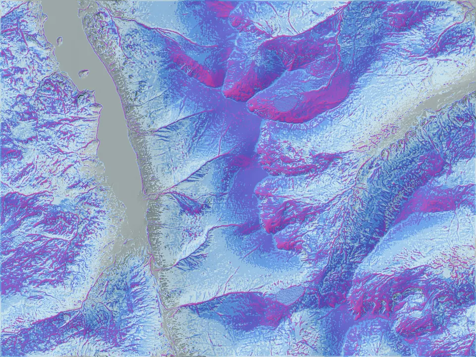
The Helvellyn examples on this site place modelled snow and avalanche-related layers on a four-metre LiDAR-derived terrain grid. Four metres describes the spacing of that terrain representation. It does not mean that snowfall was measured every four metres, that the atmospheric forecast has that resolution, or that each output cell has been independently verified.
The value is the ability to ask more specific questions: where might a ridge accelerate the flow, which hollows could collect redistributed snow, or where does terrain below a potential release area increase exposure? These are testable model hypotheses.
Keep three scales separate
Terrain scale: the elevation grid and derived landforms used to represent the ground. Source quality, acquisition date, vegetation treatment and resampling affect what the grid can describe.
Environmental input scale: the weather, snow history or satellite information supplied to the model. These inputs have their own spatial coverage, timestamps and uncertainty. A finer terrain grid cannot recover information absent from those inputs.
Output and observation scale: the place, time interval and physical quantity represented by a result or measurement. A point instrument, a slope observation and an area-scale hazard assessment should not be treated as interchangeable tests.
Read each layer as a different claim
| Layer | Question it explores | Evidence needed to test it |
|---|---|---|
| Snow depth | Where might snow accumulate or be removed? | Dated depth measurements with location, survey method and uncertainty. |
| Relative release | Where do modelled snow and terrain ingredients favour release? | Located events and a defined comparison sample. A relative index is not an event probability. |
| Terrain exposure | What ground may be affected by release areas above? | Mapped release and runout evidence, with location uncertainty. |
| Persistent weak layer | Where might a buried weak layer persist and matter? | Snow profiles and stability observations. Terrain and weather alone do not confirm a buried layer. |
| Full-depth / glide | Where might whole-cover movement have supporting conditions? | Ground-interface conditions and observed movement or release timing. |
| Cornice growth | Where might fresh wind-driven rim growth occur? | Repeated, dated observations of ridge edges and snow transport. |
The public avalanche modelling page explains these layers alongside the images. They support research and comparison; official avalanche information and field assessment remain essential to mountain decisions.
Inspect the implementation
Mountain Conditions publishes the snow and terrain calculations, including the distinction between its own compact seasonal model and representative SLF SNOWPACK columns, the linearised terrain-flow deposition proxy and the deterministic release index. The note includes example coefficients and explains why a relative index is not a release probability.
The radar processing account identifies the RTC source imagery, grid alignment, backscatter-change calculation, screening threshold and limits of the quality masks. Neither account establishes independent accuracy or a guarantee about an individual slope.
Separate reconstruction from forecast verification
A historical reconstruction asks whether a model can reproduce aspects of a documented event using the information available to the reconstruction. A prospective forecast test asks what was predicted using only information available before the target time.
For the second test, preserve the forecast as issued, including its issue time, valid time, input versions, model version and subsequent corrections. Separate cases used to tune the model from those used to assess it. Report exclusions and missing observations so the evaluation population is visible.
In avalanche work, a catalogue entry can provide evidence that an event occurred. The absence of an entry does not prove that no avalanche occurred. Reported-event matching alone therefore cannot establish the false-alarm rate for all slopes and days.
A minimum record for a reviewable result
- The question, region, dates and intended use.
- Input provenance, source licences, timestamps and quality flags.
- The model or production version, settings needed to identify the run, and preserved output.
- The observation or event evidence and its spatial and temporal uncertainty.
- The comparison method, baseline, exclusions, failures and limits on generalisation.
This is our recommended evaluation record. Access to proprietary implementation can be agreed for a defined review without making the code or calibration publicly reusable.
Evidence and further reading
- Spatial Terrain: avalanche terrain layers, the public layer meanings used in this note.
- Mountain Conditions: retrospective case evidence, source-linked avalanche reconstruction examples.
- Mountain Weather: forecast method and evidence, the measurement basis and limits of its development wind comparison.
This note explains how to interpret existing displays and plan evaluation. It introduces no new experiment, performance score or claim of independent validation.