Terrain, not just vectors
Elevation evidence is interpreted into contours, crags, gullies, scree and rock structure instead of relying only on pre-drawn feature lines.
Live cartography explorer
Explore a continuous 5 × 9 km corridor from the volcanic terrain around Magni and Móði into the Þórsmörk valley. Every scale covers the same 45 km² footprint, with seamless production tiles revealing more detail as you move and zoom.
Terrain: ArcticDEM © Polar Geospatial Center/NSF. Icelandic base mapping: IS 50V public geodata collaboration. Glacier and crevasse data: Icelandic Meteorological Office. Lava and crater data: Náttúrufræðistofnun. Supplemental paths: © OpenStreetMap contributors.
Elevation evidence is interpreted into contours, crags, gullies, scree and rock structure instead of relying only on pre-drawn feature lines.
Authoritative local sources are brought into one visual grammar, reducing the abrupt changes in quality and aesthetics that occur between mapping jurisdictions.
Purpose-built day and night palettes preserve the hierarchy of paths, water and terrain rather than applying a blunt inversion to a daytime map.
Development demonstration. Not a substitute for current official navigation, volcanic information, glacier hazard advice or field assessment.
Cartographic system
General-purpose vector maps provide valuable global context, but the vectors alone cannot describe the ledges, crag faces, scree, glacier structure and small terrain forms held in elevation data. National mapping can be richly drawn, but coverage, conventions, digital access and visual treatment change across borders.
Spatial Terrain bridges that gap. Elevation, contours, hydrology, land cover, access, named features and specialist regional datasets are reconciled into one coherent cartographic system. The visual hierarchy can then be adapted for operational, research or public-facing work without losing the character of the ground.
Day and low-light maps are designed as separate semantic themes rather than simple colour inversions. The same terrain can be delivered from detailed 1:5,000 mapping through wider 1:10,000 and 1:25,000 context, for print, digital tiles and GIS use.
Regional studies
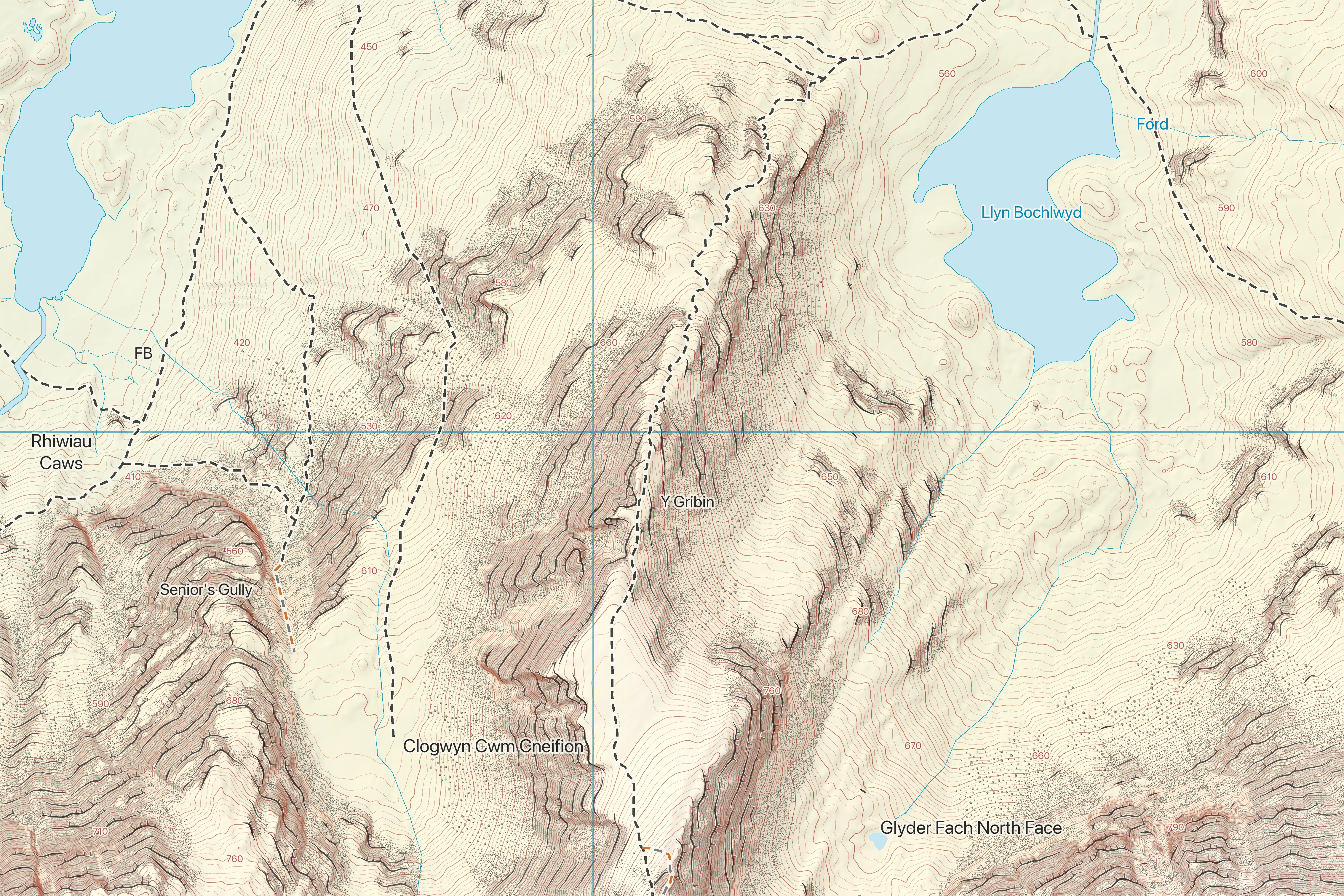
Map content is a development render and is not a substitute for current official navigation or hazard information.
Commissioning
A commission begins with its users, decisions, physical format and authoritative source data. The hierarchy can then be adjusted for navigation, interpretation, land management, research communication or public display.
The cartographic system is under active development. Example maps demonstrate production capability and are not substitutes for current official navigation or hazard information.
Discuss a mapping requirement