Research capability
Avalanche terrain modelling with LiDAR.
We combine open LiDAR terrain, our seasonal snow model and representative SLF SNOWPACK profiles to examine how snow conditions vary across a mountain. These spatial layers support reconstruction, model evaluation and professional review.
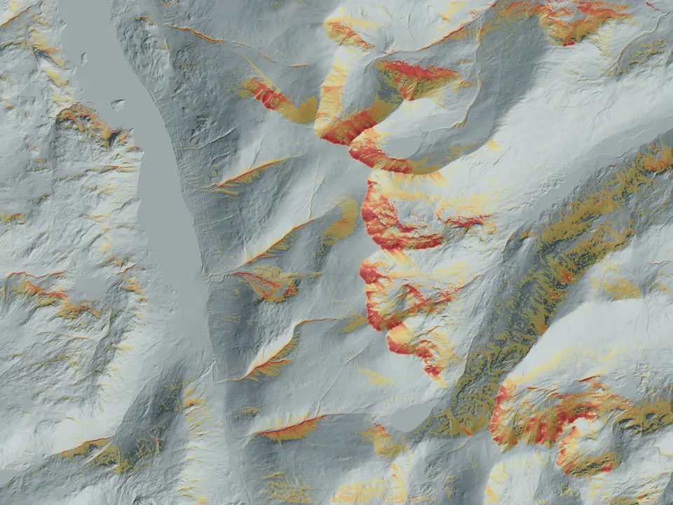
- Terrain
- LiDAR-derived grids
- Resolution
- 4 m research model
- Output
- Comparable spatial evidence
- Use
- Research and professional application
Method
From weather and snowpack to terrain.
Mountain weather is not experienced as a single value. Wind direction, elevation, aspect, shelter, surface form and temperature history change how snow is deposited and transformed across a slope. Spatial Terrain combines these controls with high-resolution terrain to describe the relative pattern of snow and avalanche evidence.
The layers are designed to remain interpretable. Each output states what it represents, the scale of the terrain model and the boundary between model evidence and field confirmation.
Research layers
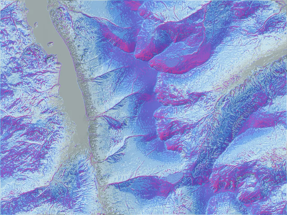
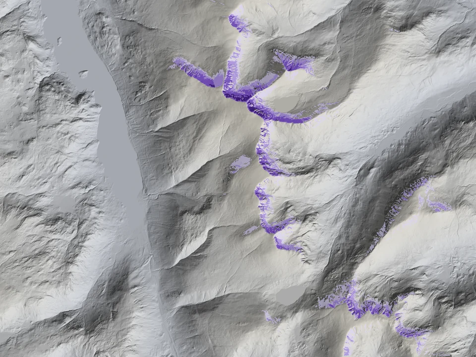
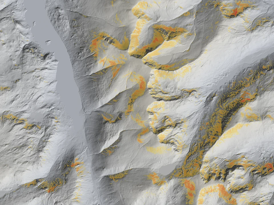
- Snow depth maps modelled redistribution by wind, elevation, aspect and terrain shape.
- Relative release compares where snow conditions and terrain may combine to make release more likely than nearby ground.
- Terrain exposure represents release areas, potential debris paths, cornices and terrain traps.
- Persistent weak layer maps where a buried weak layer may remain plausible and relevant to slab release.
- Full-depth and glide combines ground conditions, snow depth, slope and surface roughness.
- Cornice growth isolates fresh modelled growth at cornice-prone ridge edges.
Evidence
Different questions need different layers.
Mountain Conditions films
See the terrain and snow layers in context.
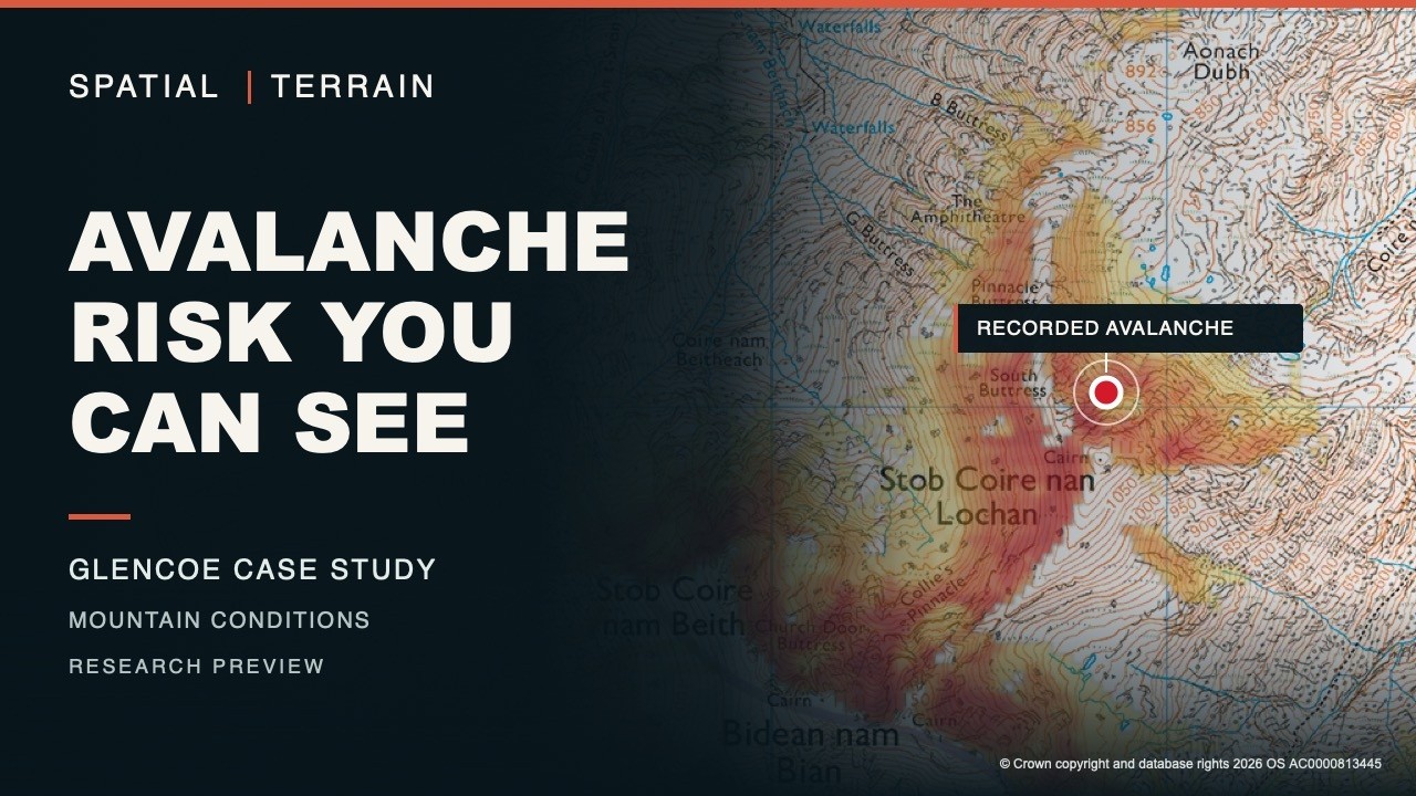
A research preview bringing aspect, elevation and modelled snow depth into a mountain-specific view. It illustrates an approach, not independently verified forecast accuracy. SAIS remains the authoritative avalanche forecast for Scotland.
Loading the player connects to YouTube. Privacy details.
Watch on YouTube →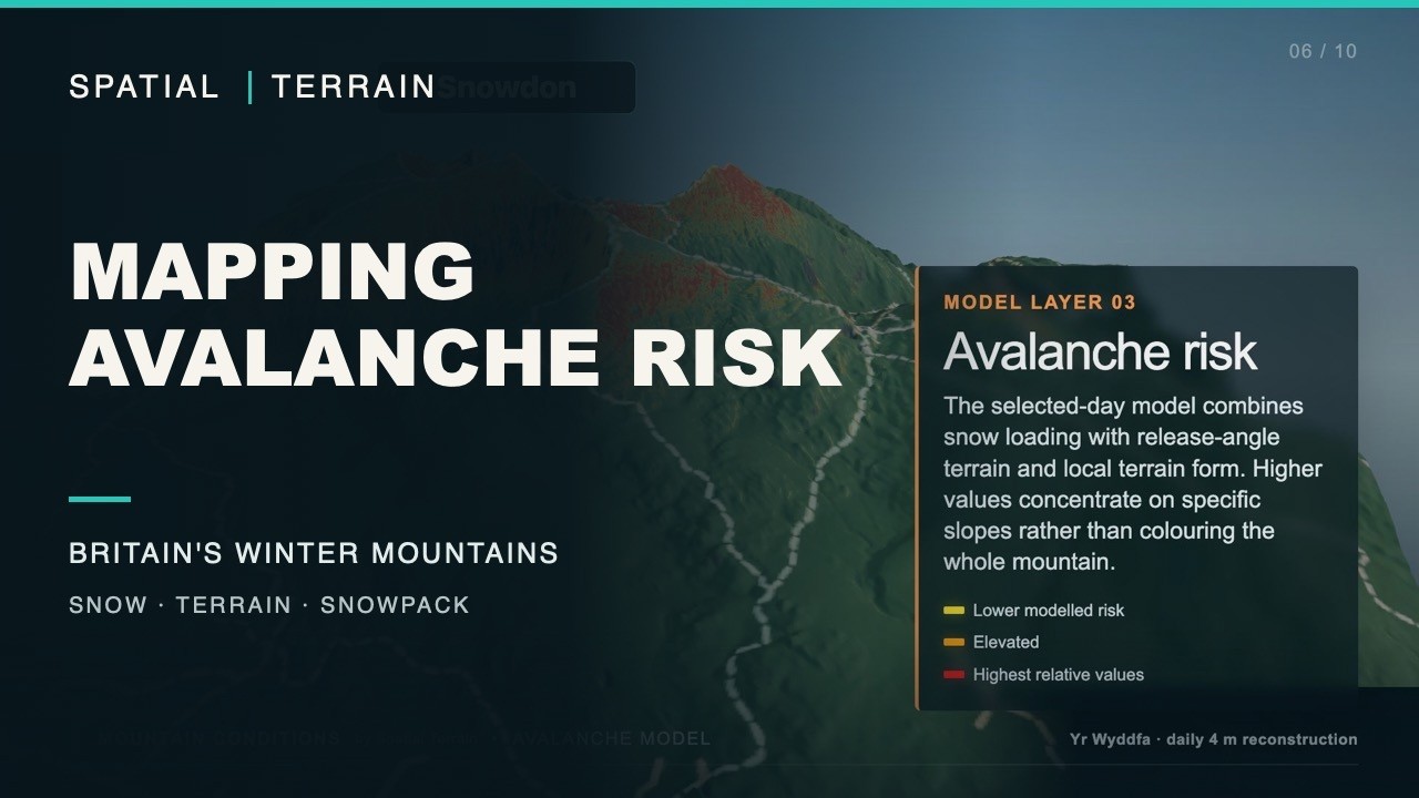
Snow depth, avalanche-related layers and snowpack change displayed on three-dimensional terrain. These are modelled patterns, not measured snow depths or a slope-safety assessment.
Loading the player connects to YouTube. Privacy details.
Watch on YouTube →How it works
Different calculations answer different questions.
Mountain Conditions is our snow and terrain decision-support framework for the UK uplands. Lake District and Eryri pilots use open one-metre LiDAR to prepare detailed terrain grids. Scottish work includes historical incidents, archived-forecast comparisons and targeted radar checks, with further detailed terrain coverage a development priority.
This is a research preview. Scotland's current avalanche forecasts remain the responsibility of SAIS. The work is independent, not a partnership or an alternative Scottish danger bulletin.
Snow history and terrain placement
Our own compact seasonal model carries snow, heat, water and buried interfaces forward hour by hour. WSL SLF SNOWPACK adds detailed vertical profiles for representative elevations and aspects, not a full simulation at every map cell. Depth is placed using aspect, elevation and local landform; fractional snow cover is also used where a run includes the bulk Snow Mass profile.
Fresh wind deposition uses a separate linearised neutral-flow model, solved by Fourier transforms for 16 wind directions. The day's snow-transport weights favour places where the calculated flow slows. This is a deposition proxy, not a fully coupled three-dimensional transport simulation or a measurement of drifting behind individual boulders.
Release potential and exposure
The relative release index combines fresh loading and standing snow with snow presence, terrain and the active wet-snow and persistent-weak-layer mechanisms. Its thresholds and weights are project rules, not release probabilities. Terrain below a potential release is assessed separately for runout and consequences.
A 4 m cell describes the terrain grid, not weather accuracy, a measured snow depth or a stability test. Historical ERA5 weather is roughly 25 km; representative snow columns do not establish weak-layer continuity across a slope.
Inspect the recorded-event comparisons, including misses. Development fits and historical matches are not independent forecast validation.
Application
Built for examination, not automatic certainty.
Potential applications include research collaboration with avalanche forecasting services, comparison against observations, evaluation of terrain controls and development of decision-support systems. Outputs can be adapted to different terrain sources, model inputs and operational questions.
Interpretation limit. These experimental layers are not avalanche forecasts. They do not replace field observations, snow profiles, official hazard information or expert judgement.
Discuss avalanche terrain research