Spatial Terrain Technical Notes
What does a four-metre model tell us?
Our first note separates terrain detail from measured accuracy and links to the calculations behind snow depth, release potential and radar screening.
Read ST-TN-001 →Spatial Terrain
Spatial Terrain is an independent geospatial engineering company founded by Simon Grogan. We develop detailed mountain maps and snow models using open LiDAR, weather inputs, SLF SNOWPACK and Sentinel-1 satellite radar.
View the research systems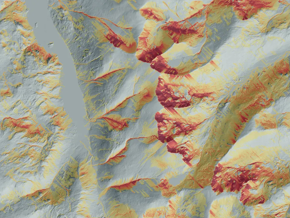
Daily snow conditions are mapped onto detailed terrain. The layers show where snow may collect, where release conditions may be stronger and where terrain may increase the consequences.
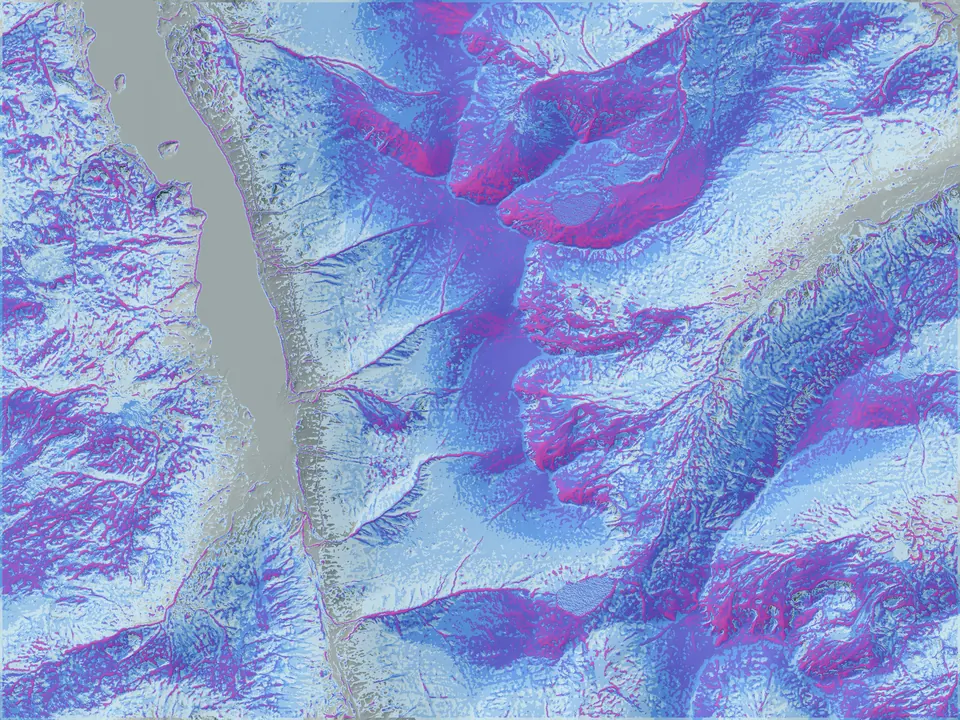
Interpretation limit. These are experimental research layers. They express relative modelled evidence and do not replace an avalanche forecast, field observations, snow-profile evidence or expert judgement.
Explore avalanche terrain modelling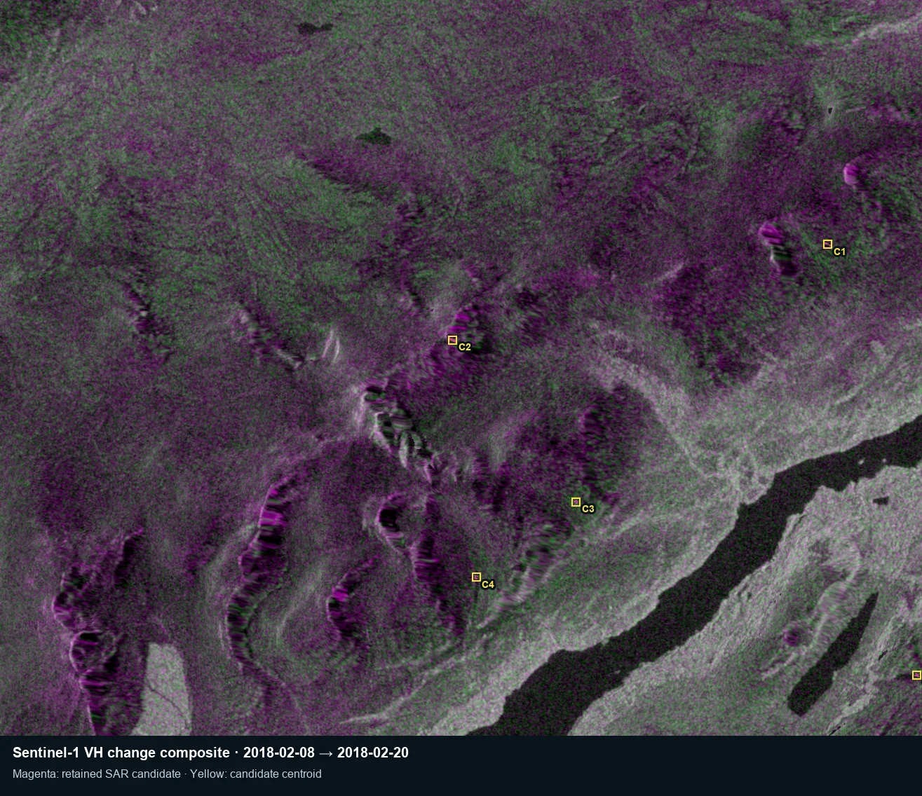
Mountain Conditions applies established Sentinel-1 satellite radar research to UK avalanche screening. This proof-of-concept view shows surface changes identified for further analysis, not confirmed avalanches.
Publication-quality terrain mapping can be produced across regions from high-resolution elevation and authoritative local data, while retaining one coherent cartographic system.
Production system under active development.
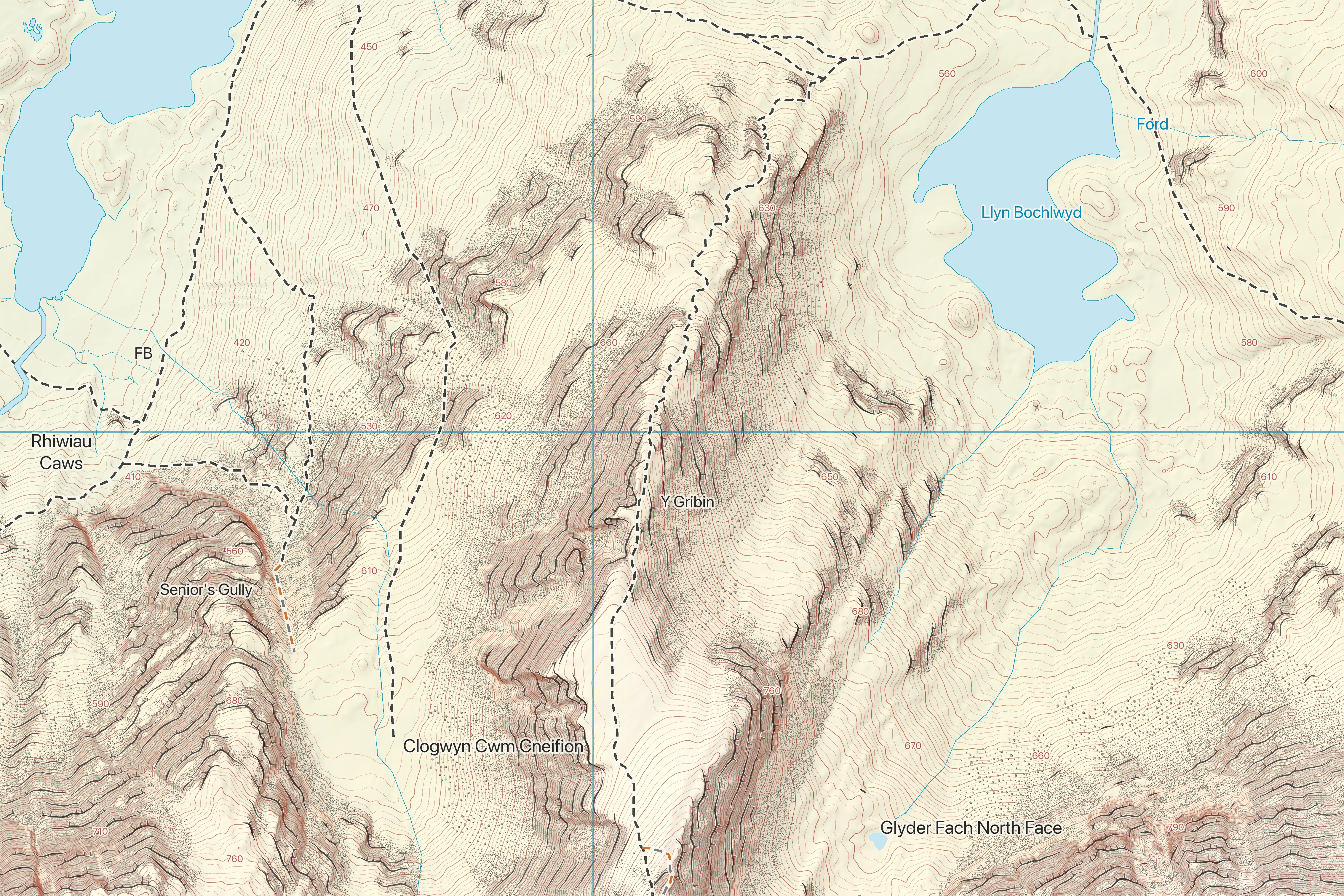
Symbols, colour systems, labelling, feature priorities and hazard overlays can be changed to suit the operational or public-facing requirement.
Close site plans and signboards, route sheets, planning material, volunteer field maps, print output, digital tiles and GIS delivery.
Elevation, hydrology, land cover, access, named features and specialist datasets are reconciled to the projection and source quality of each region.
Map content is a development render and is not a substitute for current official navigation or hazard information.
Explore high-resolution mountain cartographyResearch and evidence
Technical notes, recorded-event comparisons and development studies explain what the systems do, how to interpret the results and what still needs testing.
Spatial Terrain Technical Notes
Our first note separates terrain detail from measured accuracy and links to the calculations behind snow depth, release potential and radar screening.
Read ST-TN-001 →Public weather service
Mountain-specific forecasts and weather intelligence, with published methods and development comparisons against observations.
Explore the evidence →Snow and avalanche research
Snow and terrain models examined alongside documented avalanche events, with the source evidence and interpretation limits available to inspect.
Explore the case evidence →SPATIAL TERRAIN LIMITED develops Mountain Weather and Mountain Conditions alongside our cartography and terrain research. We bring technical development and practical mountain questions together for mapping organisations, land managers, researchers and outdoor technology partners.
About Spatial TerrainFor commissioned mapping, terrain studies, technical evaluation and software or data integration. See how we scope a project →
hello@spatialterrain.com